

Big Creek Watershed Study
Posey County, Indiana
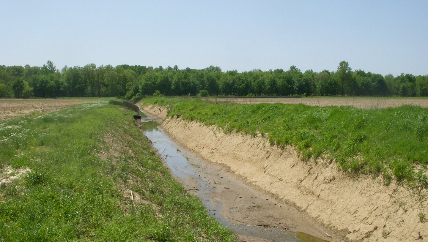
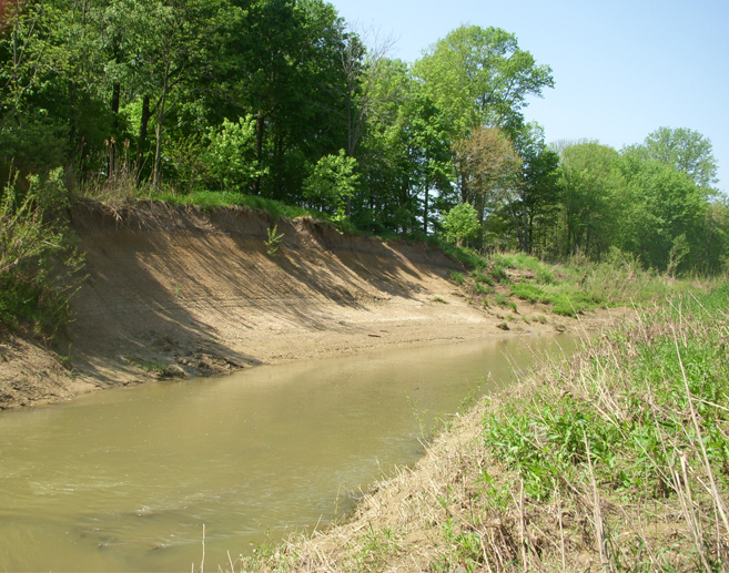
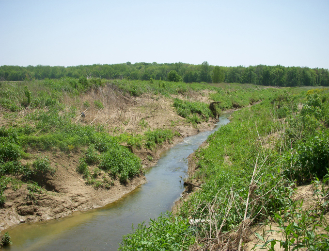
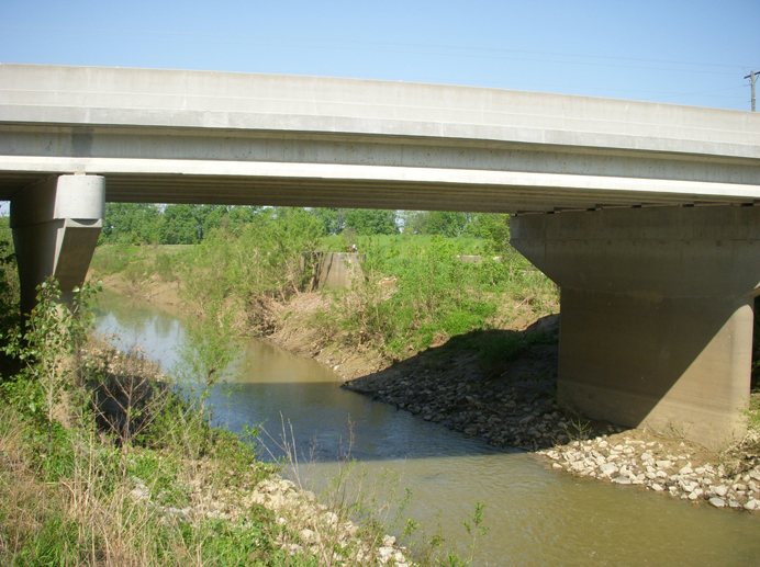
This project involved the study of a specific part of the Big Creek Watershed between SR 66 and SR 69 to determine the probable cause of the recent increase in flooding in this area of the watershed and propose solutions to the flooding problem. Hydraulic and hydrologic analyses of the approximately six-mile-long study area were performed using available stream gauge and rainfall data, GIS data, and topographic data. A HEC-RAS model was created from the available data to determine approximate flood elevations. Projects upstream of SR 66 were also investigated to determine their effects on the stream flow downstream in the study area.
Meetings with the Posey County Surveyor, Posey County Drainage Board, and property owners were also held to gain information on observed conditions over time and to update interested parties on the study's progress. Funding options for the proposed solution were also examined. The final study report was delivered in October 2008.
News
- American Structurepoint Is Expanding Its Services To Akron, Ohio
- Tyler Nix Joins American Structurepoint’s Business Development Team
- Roundabout is Expected to Enhance Driver and Pedestrian Safety at State Route 44 and Kepler Road
- Hays County To Begin RM 3237 Intersection Safety Improvements
- Whit Friend To Lead American Structurepoint’s Texas Road Group
- Noblesville Unveils Mural at New Pleasant Street Pedestrian Tunnel
- Fast Times in Cincinnati
- INDOT Touts Value Engineering That Saves Taxpayer Dollars on Projects
- Cindy Peck Joins American Structurepoint’s Cleveland Team
- Rick Conner Reflects on 50-Year Journey from Intern to CEO
- Logistics Park Sets Stage for Ambitious Industrial Development Expansion
- American Structurepoint Doubles Office Footprint in Tampa
- Reneé Ross To Lead American Structurepoint’s Texas Market Sectors
- Kyle 2022 Road Bond Projects See Movement
- Richland County Transportation Plan Survey to Open This Month
- Allison Transmission Innovation Center in Indianapolis, Indiana Receives ACEC National Engineering Excellence Awards Recognition
- Range Line Road Corridor in Carmel, Indiana Receives ACEC National Engineering Excellence Awards Recognition
- American Structurepoint Achieves Number 2 Ranking on Columbus Business First Largest Central Ohio Engineering Firms List
- Pulchritudinous Peonies Paint Pleasant
- Announcement from CEO Rick Conner, PE, SE
- Range Line Road Corridor in Carmel, Indiana Receives ACEC Indiana Engineering Excellence Awards Recognition
- Allison Transmission Innovation Center Receives ACEC Indiana Engineering Excellence Award
- Serve & Protect – Lafayette's New Public Safety Center Opens
- Parma's Ridgewood Golf Course Clubhouse & Community Center Set To Open Summer 2024
- American Structurepoint Provides Support to Project Consultant Team for the Brent Spence Bridge Corridor Project
- American Structurepoint Receives Employer of the Year Award from Women Transportation Seminar Notheast Ohio
- IU Health Announces New Facility To Be Built By Fall 2024
- Mike Arnold Joins American Structurepoint as New Florida Bridge Team Leader
- ACEC Indiana Honors Don Corson as Consulting Engineer of the Year
- Welcome to the US Roundabout Capital
- American Structurepoint Celebrates Dedication of the Lafayette Public Safety Center
- What You Need to Know to Pursue an Environmental Services Career
- American Structurepoint Earns National Award for Ongoing Hospital Project in Downtown Indianapolis
- American Structurepoint Earns National Recognition Award from the American Council of Engineering Companies
- County Roundabout Project Earns National Recognition
- Hays County Roundabout Recognized by the American Council of Engineering Companies
- American Structurepoint Podcast Celebrates National Surveyors Week
- Wright-Patterson Air Force Base Hangar Conversion Project Receives Top Honor in 2022 Air Force Design Awards
- American Structurepoint Podcast Celebrates National Engineers Week
- What You Need to Know to Pursue A Career in Transportation Engineering
- What You Need to Know to Pursue A Career in Environmental Engineering
- What You Need To Know to Pursue A Career in Civil Engineering
- What You Need To Know to Pursue A Career in Structural Engineering
- Wright-Patterson AFB Hangar Conversion Named Best Regional Project By ENR Midwest
- American Structurepoint Celebrates Completion of the Transform 66 Outside the Beltway Project in Virginia
- Hays County Celebrates Opening its Newest Roundabout
- Interesting Tips for How to Protect Your Home or Business
- Roundabouts Improve Safety and Solve Complex Traffic Issues
- Project Spotlight: Transform 66 Outside the Beltway
- American Structurepoint Wins 2022 ACEC Indiana Grand Project Award
- Kaitlyn Currie, PE, Named ASCE Younger Member Engineer of the Year
- Project Spotlight: Allison Transmission Innovation Center
- Purdue University and American Structurepoint Receive National Engineering Award for Newman Road Underpass Project
- City of South Bend’s Enhanced Long Term Control Plan Wins Approval
- American Structurepoint Wins $500 Million Rota MACC
- Newman Road Project Receives Indiana Engineering Achievement Award
- SR 37 Corridor Drainage System Cited in National Engineering Competition
- Greg Henneke Achieves ASCE Fellow Distinction
- Glasswater Creek of Plainfield Receives National Recognition For Design Excellence
- American Structurepoint to Serve As Advisor for 16 Tech Signature Bridge Project
- Noblesville Wastewater Treatment Upgrades Cited In National Engineering Competition
- Company Provides Engineering Services to Red Line Bus Rapid Transit Project
- American Structurepoint Begins New Era – Relocates to 9025 River Road
- South Bend Smart Streets Initiative Wins First-Place ARTBA Globe Award
- Will Conley Joins American Structurepoint as Principal
- Diversification Drives American Structurepoint's Success
- City of Green Roundabout Project Wins ACEC Ohio Engineering Excellence Award | American Structurepoint
- American Structurepoint Projects Receive Three ACEC Indiana Awards
- American Structurepoint Hires Walid Gemayel, PE, as Senior VP of Ohio Team
- Sportsplex Groundbreaking Keeps Hammond Hot Streak